General Plan Consistency Re-Zoning
Introduction
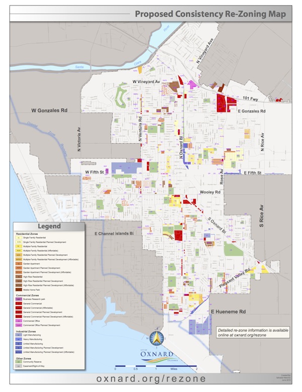
As part of the City’s 2030 General Plan update, the City concluded with various changes in zoning are required to bring a parcel zoning into conformance with the General Plan land use designation. The City conducted a series of public workshops designed to inform the community regarding the consistency changes. No development was proposed as part of this program.
Consideration of proposed changes in zoning was evaluated in the previously-certified 2030 General Plan Program Environmental Impact Report (PEIR) in accordance with CEQA Guidelines.
Meeting History
Planning Commission June 20, 2019
Staff Report
Planning Commission, October 18, 2018
Staff Report
Background Information
State law requires each county and city to prepare and adopt a comprehensive and long-range general plan for its physical development. The city must ensure that the general plan and it’s component parts comprise an integrated, internally consistent, and compatible statement of development policies. The choice of the planning horizon is up to each city but is usually at least 20 years. Oxnard’s planning horizon is the year 2030.
One of the many things that a general plan does is designate the general distribution and intensity of land uses within the planning area. A comprehensive general plan provides a city with a consistent framework for land use and other decision-making. The general plan and its maps, diagrams, and development policies form the basis for city zoning, subdivision, and public works actions. Under California law, most local government development, public works, and related decisions are required to be consistent with the adopted general plan.
Interactive Map
An interactive web viewer is available to view the proposed changes.
Map Image (Click to download PDF)
Contact Information
To submit inquiries, email: rezone@oxnard.org or call Chris Williamson 805-385-8156