Maps
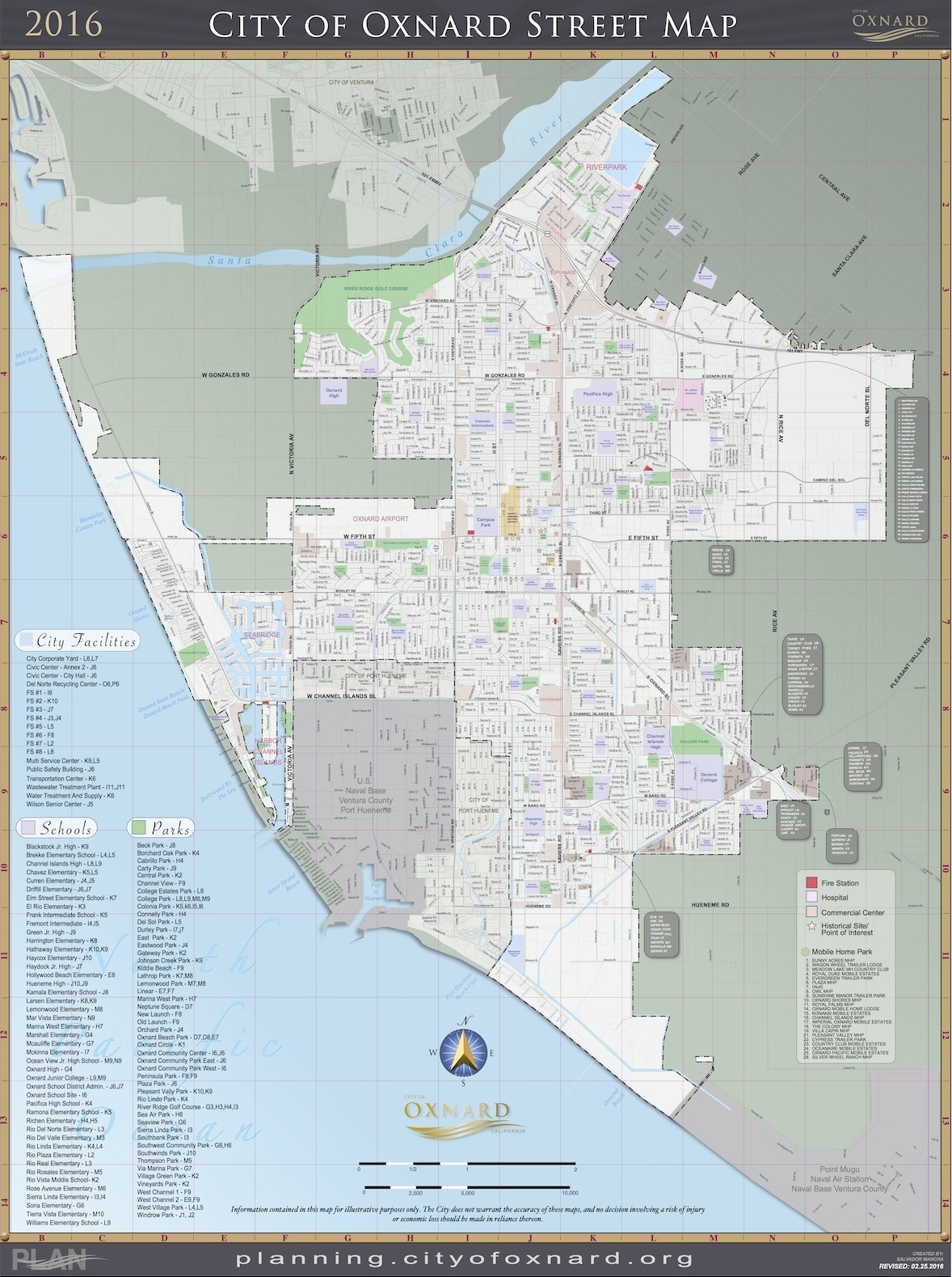
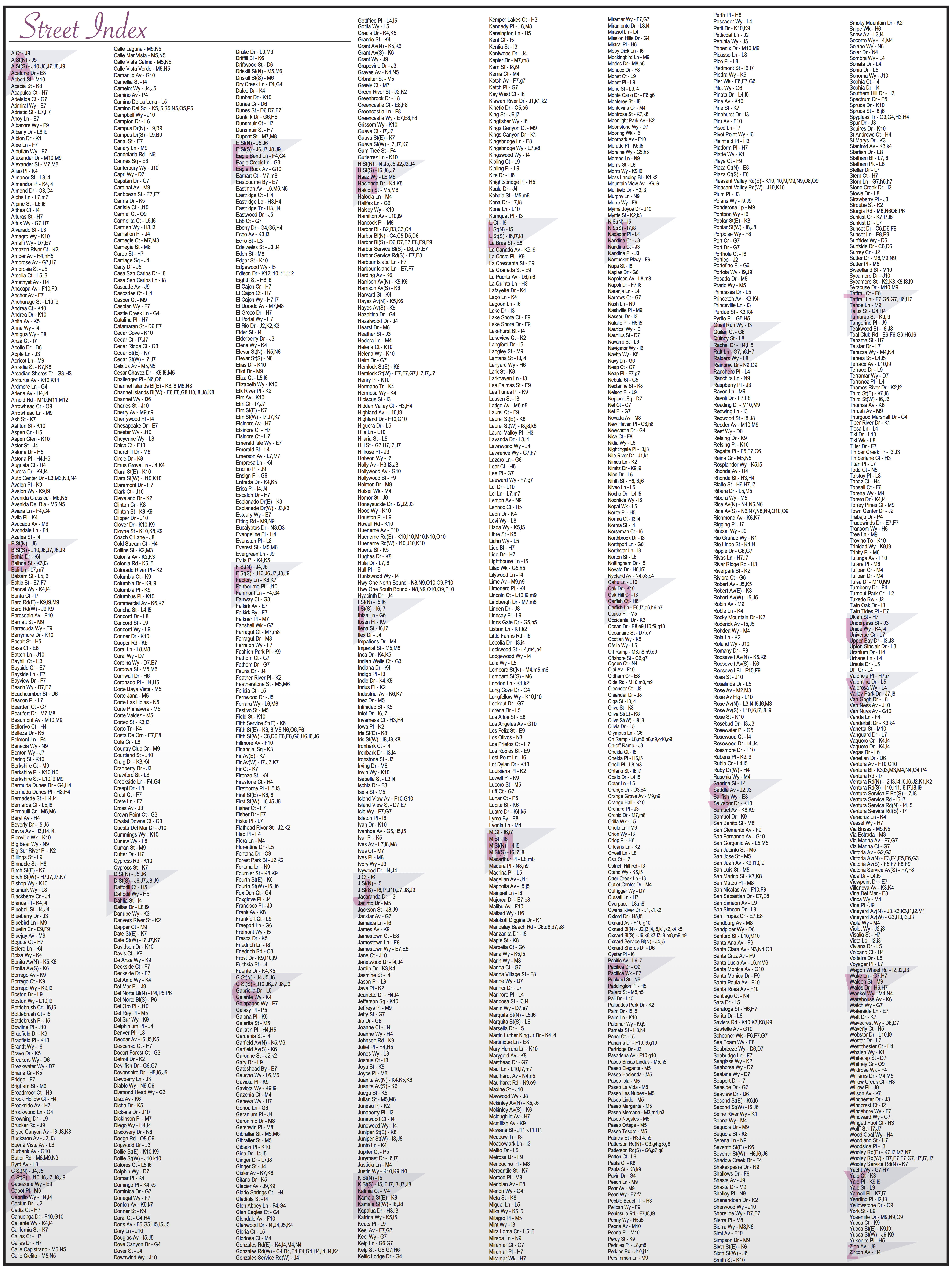
Map Disclaimer: The mapped data is derived from the City of Oxnard GIS Program, which is developed and operated solely for the convenience of the City. The maps are for illustrative purposes only. The City does not warrant the accuracy of these maps, and no decision involving a risk of injury or economic loss should be made in reliance thereon.
Oxnard Jurisdictional Boundaries Map
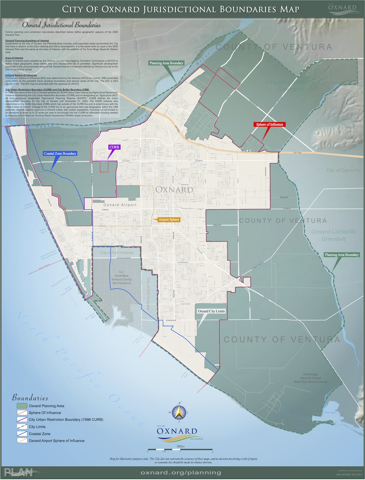
Oxnard Jurisdictional Map 30×40
Oxnard 2030 General Plan

Oxnard Zoning Map

Zone Map [30x40] High Definition (40Mb) May not load on all devices.

Zone Map Standard [30x40] (9Mb)
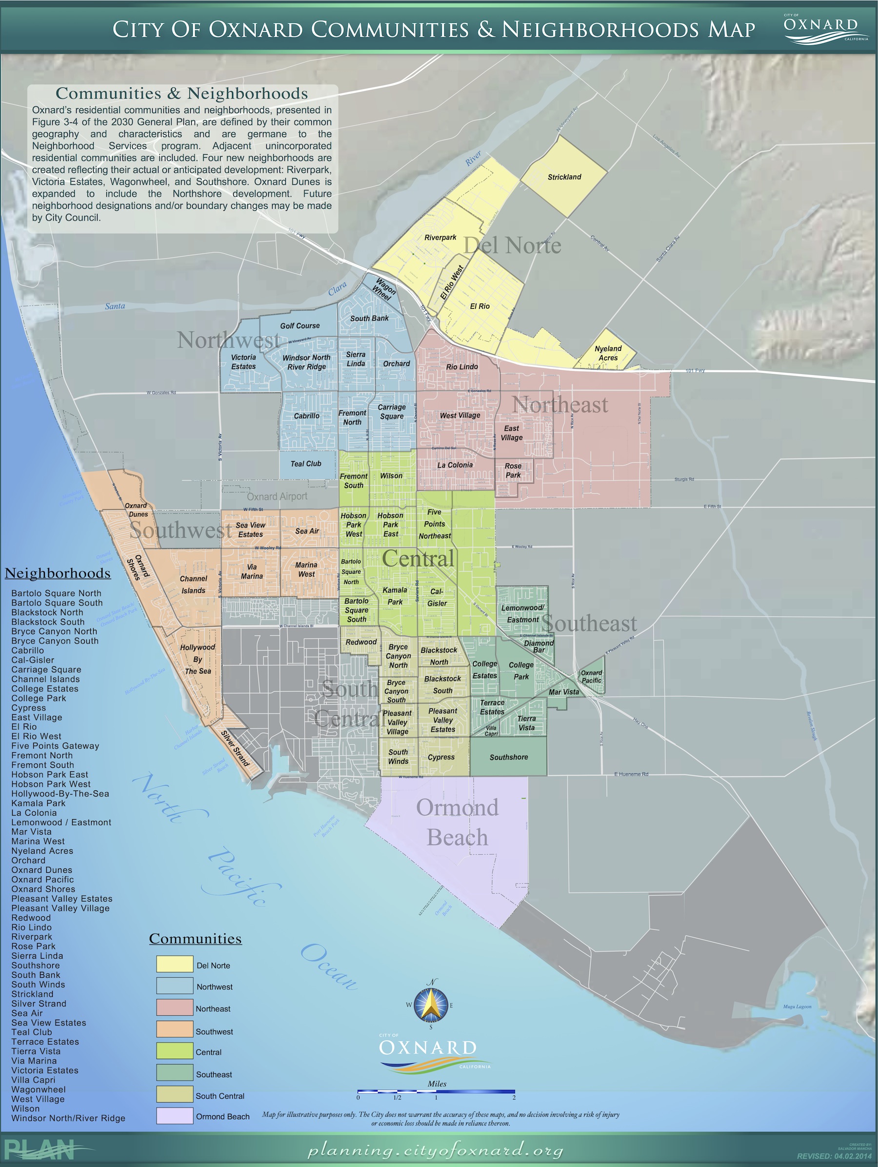
Oxnard Communities & Neighborhoods Map
Oxnard Specific Plan Areas Map
![]()
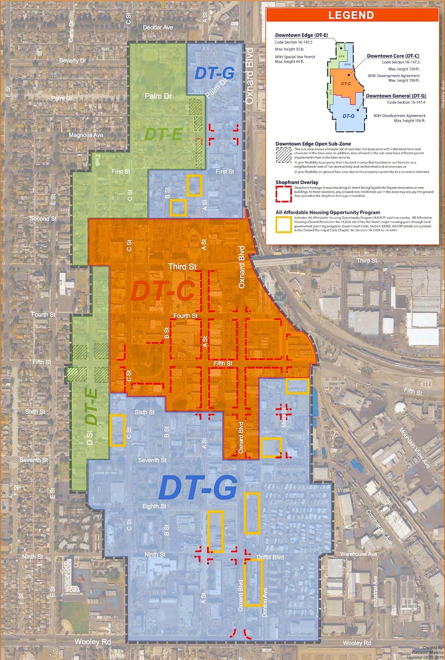
Oxnard Downtown Code Map
Oxnard Street Map
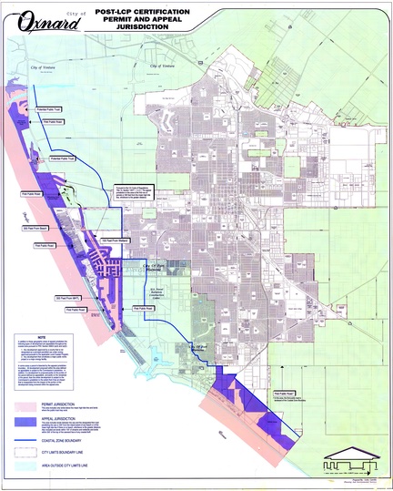
Post LCP Appeal & Jurisdiction Map